Wednesday, September 18, 2013

TRADITIONAL KILNS EVERYWHERE

Image 1. Footprint of a traditional kiln in Domusnova (Sardinia)
It's been a long time without writing. That does not mean that I have continued traveling, discovering and learning everywhere.
As I am preparing a presentation for the APT 2013 conference regarding the traditional gypsum I am now more aware of the old methods of obtaining gypsum or lime (similar procedure different times of burning). I am finding old footprints even in the most unexpected places. During my recent trip to Sardinia I found a traditional kiln in
an excursion for rock climbing in the small town of Domusnova. As it is seen in the picture, the kiln was half-excavated in the slope of the mountain to keep the heat . Usually the diameter was around 2 meters. A dome was built with the gypsum/lime stones, then a fire was set and usually the times of burning will depend of the material: usually 1 day for gypsum [1].

Image 2
Honestly this is amazing, everywhere you could build a traditional kiln. They were usually, and logically, built close to the quarry or close to the building site where was going to be used. Now they are not in use anymore in lieu of new products that you can easily buy. However, in Spain there is one factory that still "cooks" the gypsum as the traditional manner (http://www.yesoalbarracin.com). Their properties to weathering are higher than new gypsum because of several factors (procedure, heterogeneity, ...)
In this website you will find some pictures of kilns and the typical sequence of the whole process to create the gypsum mortar:
http://alfredosanchezgarzon.blogspot.com/2011/10/visita-guiada-los-hornos-de-yeso-de-la.html

Image 3. Footprint of a traditional kiln in Domusnova (Sardinia)


References:
[1] F.Vegas, C.Mileto, M. Diodato, J. Garcia Soriano, C. Grau Giménez: “Traditional Structures Made with Gypsum Pillars: A reasoned Hypothesis” in: Nuts & Bolts of Construction History, Vol. 2. Paris (2012) pp 509-516.
[2] D. Sanz Arauz in: “Análisis del yeso empleado en revestimientos exteriores mediante técnicas geológicas”, tesis doctoral, Universidad Politécnica de Madrid, Escuela Técnica Superior de Arquitectura, Departamento de Construcción y Tecnología Arquitectónicas, Madrid (2009)
 

Saturday, May 5, 2012

BELCHITE ... DONDE LOS TIROS


Salimos de Zaragoza por la Nacional de Castellón camino a Belchite. Al llegar al pueblo viejo de Belchite los buitres revolotean en lo alto; el color gris del cielo todavía hace más trágica la visión. En nuestra visita nos acompañan Clemente y Nieves vecinos de Moyuela, un pueblo de las inmediaciones. Al llegar Nieves no quiere salir del coche, ya durante el viaje nos comentaba “Belchite… donde los tiros”. Clemente en cambio viene con nosotros y nos relata que era un niño cuando se dio lugar la masacre “durante tres días se escuchaban las bombas y los tiros … sin parar día y noche”. No puedo hacerme una idea de lo que un niño de 13 años puede sentir cuando vive eso. El pueblo, todavía, está hecho añicos. Las casas están reducidas a escombros, apenas se reconocen las calles donde corrían niños y se vivía. Las únicas estructuras que se conservan son las iglesias y algún muro despistado que ha sobrevivido. El tiempo se congela mientras recorres los escombros. Al llegar a una de las iglesias la sensación de pena es total, hay grafitis de la época, las bóvedas agujereadas por las bombas, los muros desafiando al equilibrio... Según nos cuenta Clemente la batalla se dio lugar allí para frenar la persecución del ejercito fascista, con ello el ejercito republicano ganaba tiempo mientras se preparaba la batalla del Ebro.


El estado de ruina predomina en todo el pueblo, me impresiona. La ruina se ha congelado durante todos estos años. Las únicas labores de mantenimiento que puedo observar han sido algunos intentos de estabilizar las estructuras existentes y hacer accesibles algunas de las calles, pero aun así su estado inestable empeora día a día. ¿Qué hacer con está ruina? ¿Cómo poner, o no, en valor este hito histórico? Por un lado hay gente que quiere que se olvide en la memoria ya que todavía siente el dolor que transmite, para otros prefieren que se conserve para no perder esa parte de la historia vergonzosa y no cometer de nuevo los mismos errores. Siempre hay unos terceros que no tienen ni opinión ni memoria y posan por las ruinas de lo que fue la muerte para cientos de personas con su cámara en mano haciendo posturas graciosas para salir en el facebook y poder “etiquetarse” en este pueblo del pasado.


No suelo leer ni escribir sobre guerras por lo que no he contrastado la información. Pido perdón por si he cometido algún error histórico “fiable”.
Fotografía: Gabriel Pardo

Saturday, April 21, 2012

BENICARLO'S PALACE

Nicola (left) and the team during an essay with the penetrometer

This week we have visited a beatiful palace in Benicarlo (2 hours north from Valencia) from the 18th Century. Fernando Vegas and Camillla Mileto, in my opinion, two of the greatest architects, recommended us to spend some time there because this week a team from the “Italian National Research Council” specialized in the non-destructive proof and assessment of the ancient timber would be there. We spent the whole day with the Italian team and watched and learnt how they perform their work, Maria Diodato, one of the members, was our host. I took some notes and pictures which are roughly summarized below.
Here the summary of how they asses the structural timber elements.

  • First of all they measure the timber element, the cross section, the length, position, etc. Then they indentify the visual defects such as the knots in wood and their dimensions, the direction of the grain and so on. Nicola, the director of the team, taught me why the importance of the position of the knots in a structural element and how to know the effects of that.
  • Before they start to use the “Penetrometer” they check the sound of the element hitting it with a rubber hammer (with the practice you can distinguish the sound of the sound timber, they say). In those places where the timber is internal damaged they use the penetrometer to calculate the resistant cross section of the element. The penetrometer consists in a “drill device” which pushes a kind of steel needle in the timber, the resistance of the needle to go through the timber gives a graphic where you can see the resistance of the cross section. With this device you can also evaluate the heads of the beams embedded in walls.
  • Other device they use is the Hygrometer. They use it in the heads of the beams to see the inner humidity of the timber. Usually, if it is below of the 20% the timber is sound and if it is above is pretty easy to find fungi or xylophagous.
Using the Hygrometer at the embedded head of the joist

When you put all the results together you have to use the European Code to get, according to the corresponding table, the strength values for that type of wood. I remember that the American NDS has similar evaluations of the existing timber.
It is amazing how they do it, they checked every single wood element beams, joists, rafters, … They also have index cards of each one with the data they get.

Hall of the palace. Imperial stair at the background

The palace itself is gorgeous, it has an original eigtheen century kitchen, with decorative tiled walls, that is one of the best preserved in the Valencian Community and in Spain. See some pictures of the palace. I forgot to mention that the town of Benicarló has terrific beaches, weather and artichokes :)

Decorated tiled walls in the kitchen

Tuesday, April 3, 2012

Proportion?


Cast-iron beam

I am currently doing a research about a huge cast-iron construction placed in New York City in 1853. I have found the formulas used in that era to calculate the "bearing capacity" of the given beam. Two British Engineers who extensively publish their work pop, Hodgkinson and Fairbairn. Fairbairn focused in the Worought-Iron beams whereas Hodgkinson digged more in the cast-iron beams. Through their experiments, which generally consisted in bending differente shapes of beams under a known load, they usually stablished a constant "c" for each type of shape. This constant is obtained according to this formula, which is valid both for cast-iron and wrought-iron beams:

W=c*a*d / l
where:
W= max. weight
c = constant
a = area of the bottom flange
d = depth of the beam

The relation between the area of the bottom flange and the depth of the beam is directly proportional.The constant "c" is given in Tons/in2, thus this is quite similar of the yielding point in wrought iron or the breaking point in cast iron (because of its brittle fracture).
Cast iron is a strong material that performs excellent in compression but fails in tension and not mention in fireproofing. According to this, the I-Beams were shaped in bizarre flanges. Hodgkinson established a general formula to shape the cast-iron beams. According to his experiments the cast iron is 6 times stronger in compression than in tension, so it is logical using the same proportion for the flanges. Usually we find cast-iron beams where the bottom flange is between 6-6.5 times the area of the top flange.

I do not why but I really like these beams, maybe it is because each beam was cast for one place, building or purpose; with such detail hard to find nowadays.
Typical fracture of a cast-iron beam due to bending

Sunday, March 18, 2012

New Article in the CSIC magazine "Arqueología de la Arquitectura"

I am pleased to announce my publication theTeruel's Cathedral in Spain that has been published by the Spanish National Research Council (CSIC) through its annual magazine "Arqueología de la Arquitectura" (Archeology of the Architecture).
It was a hard work but I am very proud of it.
Here the link and some pics:

http://arqarqt.revistas.csic.es/index.php/arqarqt/article/view/132/127

Dark survey


Wall Stratigraphy

Gabriel

Monday, January 16, 2012

Guayabo, following the path of the CABECARS

General site view, literally in the middle of the jungle
Guayabo de Turrialba is the most important archeological site in Costa Rica. Flanked to the south by the Turrialba Volcano, the Guayabo Nacional Monumento (1973) is one of those places to visit. Monument’s tropical ambience, atmosphere and mysterious origins make for an amazing if not fascinating experience. The only archaeological park in the country, Guayabo protects the remains of a city that flourished and mysteriously disappeared before the arrival of the Spaniards. Archaeologists deduced that the pre-Columbian city was led by a chief, who exercised political and religious power over a large region. On 2009, it was declared an International Historic Civil Engineering Landmark by the American Society of Civil Engineers when it became a milestone in the engineering world for its water supply and drainage systems, designed to prevent flooding or overflow; after seven centuries of being abandoned are still working. 
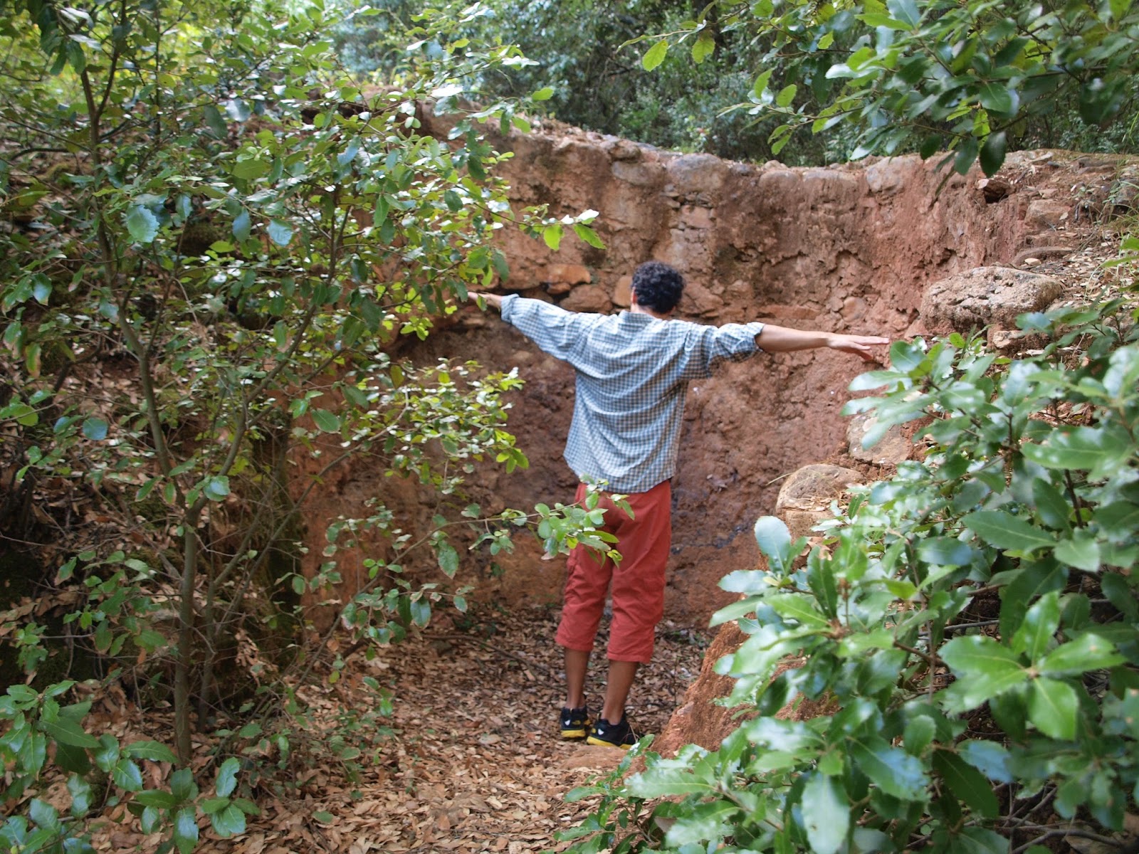
Covered aqueduct
Archaeologists are still unclear why this Indian settlement, inhabited by the Cabécar as early as 1000 BC, was abandoned around 1400 AD. Archaeologists believe that this city was a key religious, political and cultural center. The Guayabo National Monument sits on only 10% of its total land area, while the remainder 90% of the land is a premontane rainforest; this 232-hectare monument was first uncovered in 1968 by Carlos Aguilar Piedra, an archeologist at the University of Costa Rica.  In the central area of the monument are different mounds with stone foundations, which generally have a circular base of different sizes. It is believed that the houses were built on the mounts with wood and straw, and their high was the diameter of the circular base (up to 30 meters). Excavations have also revealed cobbled roads, a sophisticated city infrastructure, covered and uncovered aqueducts, mysterious petroglyphs, tombs and sculptures, which suggest a highly developed knowledge of civil engineering. Their construction techniques are influenced by both South American and Mesoamerican cultures. Since the American Indians did not use the wheel, many of their streets are equipped with stairs. 

On the field. The most elevated mount is the house of the tribal chief

Who built this lost city? Why did its inhabitants disappear just before the Spanish landed? The most accepted hypothesis mentioned diseases, internal conflicts, maybe even war.
Infrared technology applied to archeology:
On March 2003 the Costa Rica´s government and the NASA developed a project called CARTA (Airbone Research And Technology Applications), which objective was, among others, to take infrared images of the country.  Once the photographs were taken, the University of Costa Rica, represented by   Dr. Javier Bonatti González and Licda. Maureen Sánchez Pereira, did a research in order to discover Pre-Columbian roads called “Determinación de posibles rutas de intercambio precolombinas en la región central de Costa Rica usando sensores remotos avanzados” (Determination of possible exchange Pre-Columbine  roads in central Costa Rica using  advanced remote sensing). 

Infrared picture that shows the pre-Colombine roads/paths

The results of the research reveal that there were several roads between different human centers all around the country, and the fact that some of those crossed big rivers suggest the existence of bridges. The roads were approximately three meters wide and were constructed to go by feet.

People are surprised when they know that the pre-Colombine society did not know the wheel. But when you are here looking at the steep mountains you realize that a wheel is not very useful in this land.

I would like to thank you the hospitallity of the Fine Arts students and professors of the University of San José for picking us up in their bus toward Cartago.


Arriving to Cartago with one of the students, just in front of the Bar Royal a milestone in Cartago.

Following are some texts related to this subject, quoted literally:

The area of Costa Rica has been scanned with various sensors (high resolution visible camera, infra-red camera, MASTER - thermal emission and reflection radiometer etc.) in order to acquire airborne multispectral digital imagery and photographic data for the ecosystem and agricultural research, for urban and land use planning, for studying volcanic activity and hazards, for cartographic purposes and for archeological studies.
Sensors used in multispectral digital photographic imagery: (Main source: NASA Flight Summary Report)
1.    Leica RC-30 metric camera is used for natural color imagery with wavelength range 420-700nm mainly for surface mapping and monitoring. Precision photogrammetry and films may be used to generate digital elevation models.
2.    Cirrus Digital Camera System (DCS) is used for acquiring flase color infrared imagery with 510-990nm spectral range. Primary use is in habitat mapping and ecosystem monitoring.
3.    MODIS/ASTER (MASTER) is the airborne simulator of the NASA satellite instrument, orbiting on NASA's Terra satellite (ASTER - Advanced Spaceborne Thermal Emission and Reflection Radiometer and MODIS - geographic reprojection tool). It is intended primarily to study geological and other Earth surface properties. Fifty spectral bands cover 435nm - 13,110nm (13.11µm).
4.    HyMap Hyperspectral Scanner provides 126 bands across the reflective solar wavelength region of 0.45 - 2.5nm with contiguous spectral coverage (except in the atmospheric water vapor bands) and bandwidths between 15 - 20nm. High spatial and spectral resolution is used for example to differentiate a wide range of minerals at the ground surface through their characteristic absorption spectra.

Color Infrared Film (CIR):
Detects longer wavelengths somewhat beyond the red end of the light spectrum. CIR film was initially employed during World War II to differentiate objects that had been artificially camouflaged. Infrared photography has the same problems that conventional photography has, you need light and clear skies. Even so, CIR is sensitive to very slight differences in vegetation. Because buried archeological features can affect how plants grow above them, such features become visible in color infrared photography.
(From http://wwwghcc.msfc.nasa.gov/archeology/remote_sensing.html )
Sources
http://archaeologynewsnetwork.blogspot.com/2011/05/guayabo-monument-in-costa-rica.html
http://bocachica.arc.nasa.gov/CARTA_2005/index.html
http://es.wikipedia.org/wiki/Historia_precolombina_de_Costa_Rica
http://www.dfrc.nasa.gov/Gallery/Photo/DC-8/HTML/ED04-0056-059.html
http://www.ghcc.msfc.nasa.gov/archeology/remote_sensing.html
http://isda.ncsa.uiuc.edu/drupal/content/costa-rica-2050
http://www.vinv.ucr.ac.cr/girasol-ediciones/archivo/girasol25/mirada.htm
Acuña Coto, Victor, Relaciones entre asentamientos precolombinos al norte de Guayabo de Turrialba en la Fase Cabaña. Revista de Ciencias Sociales. Universidad de Costa Rica, 35: 43-52, 1987.
Aguilar Piedra, Carlos H. Guayabo de Turrialba; arqueología de un sitio indígena prehispánico. Editorial Costa Rica. San José, 1972.
Drolet, Robert, Arqueología e ingeniería hidráulica en Guayabo de Turrialba. In Primer Seminario de Ingeniería de los Recursos Hidrálicos, Colegio de Ingenieros Civiles de Costa Rica, pp. 339- 349, 1984.
Lines, Jorge A., Bibliografia antropológica aborigen de Costa Rica San Jose, Costa Rica, 1943.

St John the Unfinished

Last Saturday we had the chance to visit the cathedral of St. John the Divine, also known as St. John the Unfinished. We could see the cathedral from an unique perspective; within the walls.
Staircase of St John the Divine
This huge cathedral is the second largest Christian Church in the world after St. Peter in The Vatican. With a colossal dome in the transept of 132 ft. (40 m.) diameter built by the Spaniard Rafael Guastavino in 1909, the cathedral rises with its revival mix-style of Byzantine-Romanesque and Gothic. The size of the dome is breathtaking but from a structural point of view the most impressive aspect of it is the way it works and the way it was built. In terms of how it was built the dome is laid with 1” thick tiles and it varies in thickness from 7-1/2” (19 cm.) at the foot to 3-3/4” (9.5 cm.) at the crown. This technique of tile vaults was introduced and patented in the United States by Guastavino through his company the Guastavino Fireproof Construction Co. The construction technique to build this type of tile vaults is widely known in the Mediterranean area of Spain which name is Catalan Vault. No centering, falseworks or other provisional structures is necessary for this technique, only light scaffolds for workmen and dairy supplies are. I forgot to mention that it was accomplished in less than 3 months!
Besides the dome, the Church has other amazing elements such as the staircase which goes up the clerestory. The floor of the elliptical shaped staircase is made of 2 tile thick and a peculiar thing about the staircase is its inappreciable eye, because it does not exist. Instead of a common solid piece in the eye in this case there is just an elegant handrail made with the same tiles. The steps fly in the air, and they look like they don’t weight anything. I found a similar staircase in the medieval landmark “La Lonja de Valencia” in Spain, that was built in 1482. This latter has the same shape as St. John the Divine´s but made of curb stones instead of tiles. This staircase is absolutely beautiful. If you go to Valencia do not miss it.

Looking down

Another must see piece is the dome under the presbytery where Tiffany had his own chapel. It is made with the same technique and materials as the main dome with the advantage to watch the dome from a closer position.

Dome at Basement of the Cathedral
Finally I would like to mention the 50 foot 300 ton granite column enclosing the presbytery. With a diameter of 10 feet this columns were cut and shape in just one piece. The cylindrical shape was accomplished thanks to a big lathe made on purpose for this. When the first column was carving broke suddenly in a point close to the top, the second column had the same fortune and it happened in the rest of all columns. They were too large. That is the reason we can see a joint close to the top of the columns. The columns were cut and shaped in Vinalhaven, ME, shipped by boat to the wharf to Thirty-Fifth Street of Manhattan and carried toward 110th Street by a steam truck  moving just 50 feet per hour. The first column was placed one year after they started to dig the piece.


Column of the Cathedral before shaped
 
St John the Divine conjugates the magnitude of a middle age cathedral with the perspective of a church from the 20th Century breaking the rigid Middle-Age mold. There is no doubt that is one of the best buildings of New York, at least for me.

Bibliography:
- John Lane Co. The International studio, Volumen 40. 1910
- Munn and Co. Scientific American,Supplement, Volumen 68. 1909
- The Association. The Cornell civil engineer, Volumen 25. 1916

Websites: 
- http://query.nytimes.com/mem/archive-free/pdf?res=F60814FE3F5D11738DDDA10A94D0405B838CF1D3

*All the Photographies by the author, except the last one.